After my last trek to Hampta Pass, I couldn’t get any leave from office due to work and had lost precious trek months of August, September and October. It was towards end of November, when I finally got a chance to plan a trek.
One of my office colleague, Shweta had been asking to go on a trek. She was eager to see what a trek would be like. I was little skeptical, since she had no prior experience of trek.
One of my office colleague, Shweta had been asking to go on a trek. She was eager to see what a trek would be like. I was little skeptical, since she had no prior experience of trek.
I had not been to Tungnath before, so I chose to trek to Chandrashila starting from Devariyatal via Rohini Bugyal. It was also suitable trek in a way that it is not difficult for new trekkers.
About Tungnath
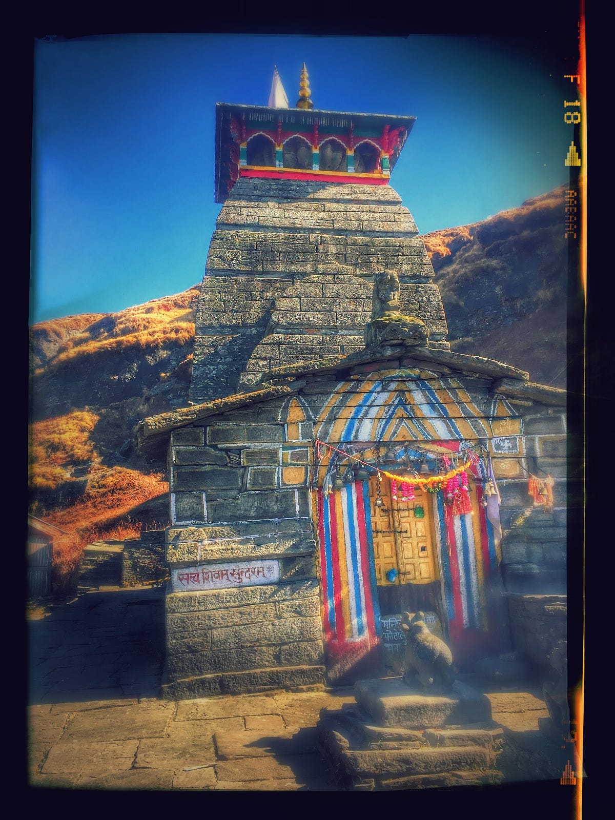
Tungnath is the highest Shiva temple in the world and is one of the five and the highest Panch Kedar temples located in the mountain range of Tunganath in Rudraprayag district, in the Indian state of Uttarakhand. The Tunganath (literal meaning: Lord of the peaks) mountains form the Mandakini and Alaknanda river valleys. Located at an altitude of 3,680 m (12,073 ft), and just below the peak of Chandrashila, Tungnath temple is the highest Hindu shrine dedicated to Lord Shiva. The temple is believed to be 1000 years old and is the third (Tritiya Kedar) in the pecking order of the Panch Kedars. It has a rich legend linked to the Pandavas, heroes of the Mahabharata epic.
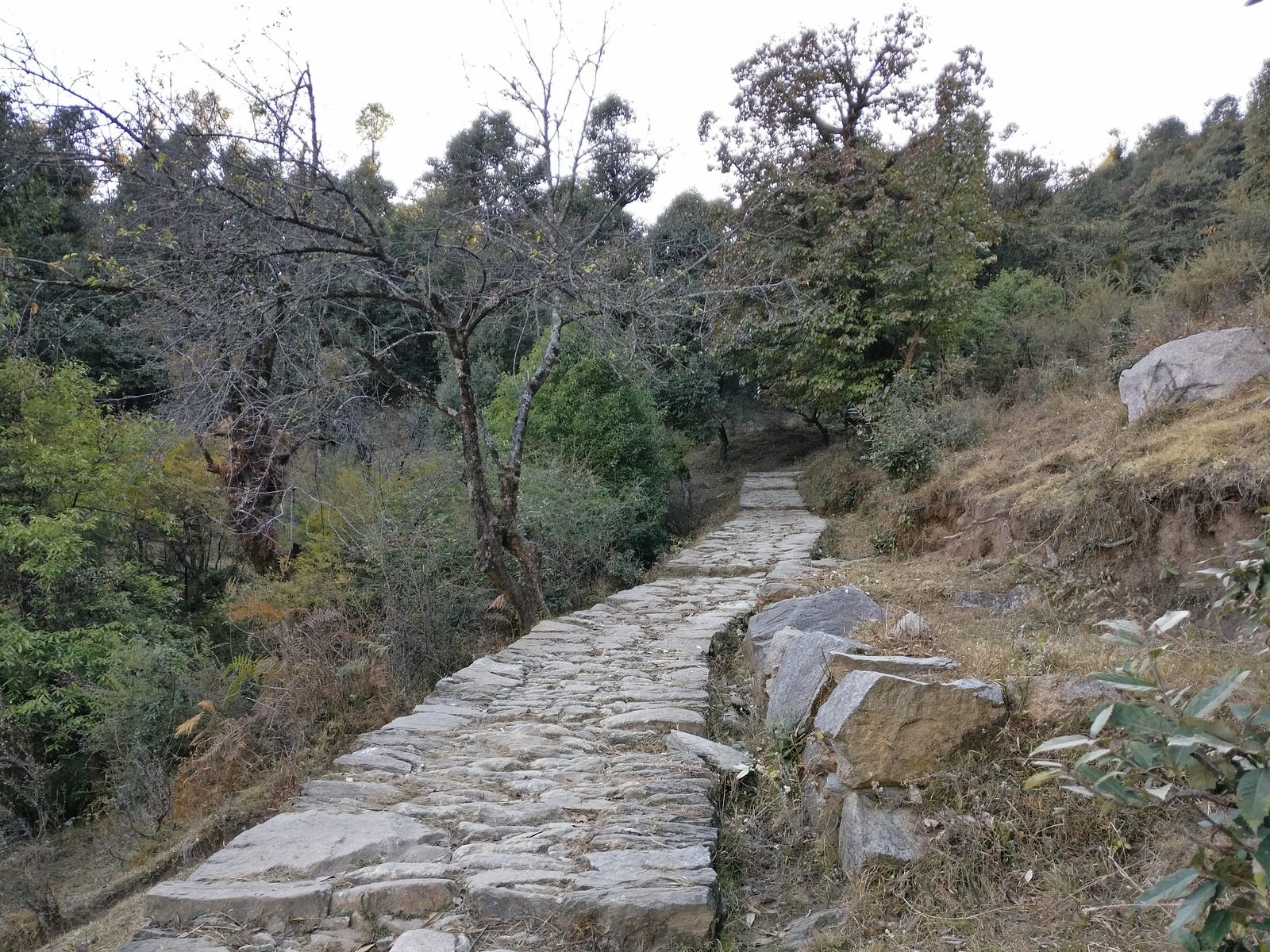
We started from New Delhi to Haridwar on Friday, 25th Nov’16 via train and we reached Haridwar at 4 in the morning. The bus stand was near by so we walked towards Bus stand soon after having tea at Railway station to catch a bus to Joshimath, Chamoli. After 6 hours of journey, we reached Rudraprayag. From there we took a cab to Sari village (Starting point of trek) as there aren’t frequent transport options towards Ukhimath road. Sari is located near Ukhimath in Rudraprayag district.
First Day of Trek
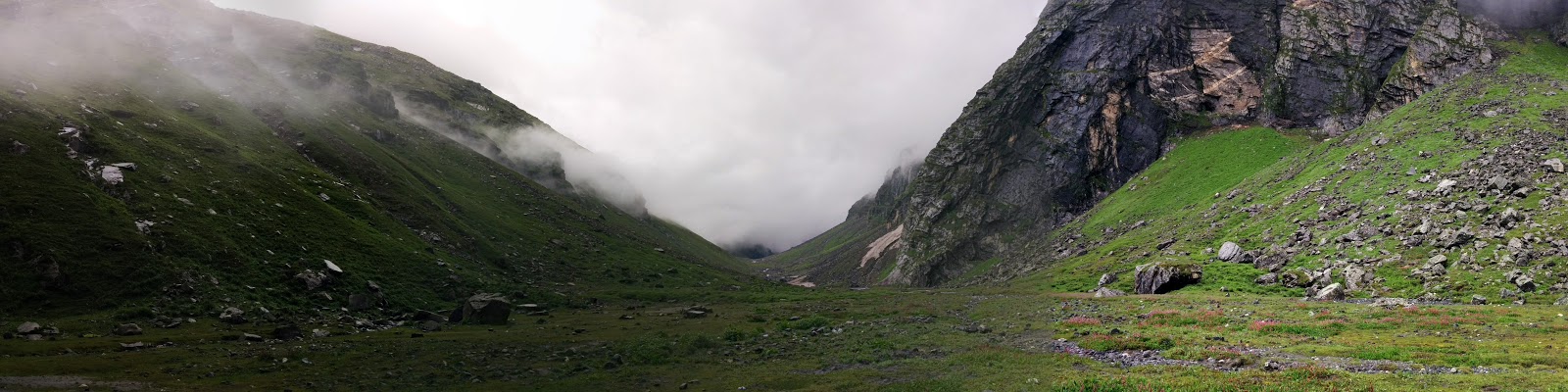
We reached the village Sari around 2 PM. We started off to Devariyatal immediately. Trek to Devariyatal is roughly 3 km climb from this village. In little more than an hour, we reached Devariyatal . There weren’t many people camping that day. In fact, there were only two tents pitched except ours. The lake Devariyatal is beauty of it’s own.
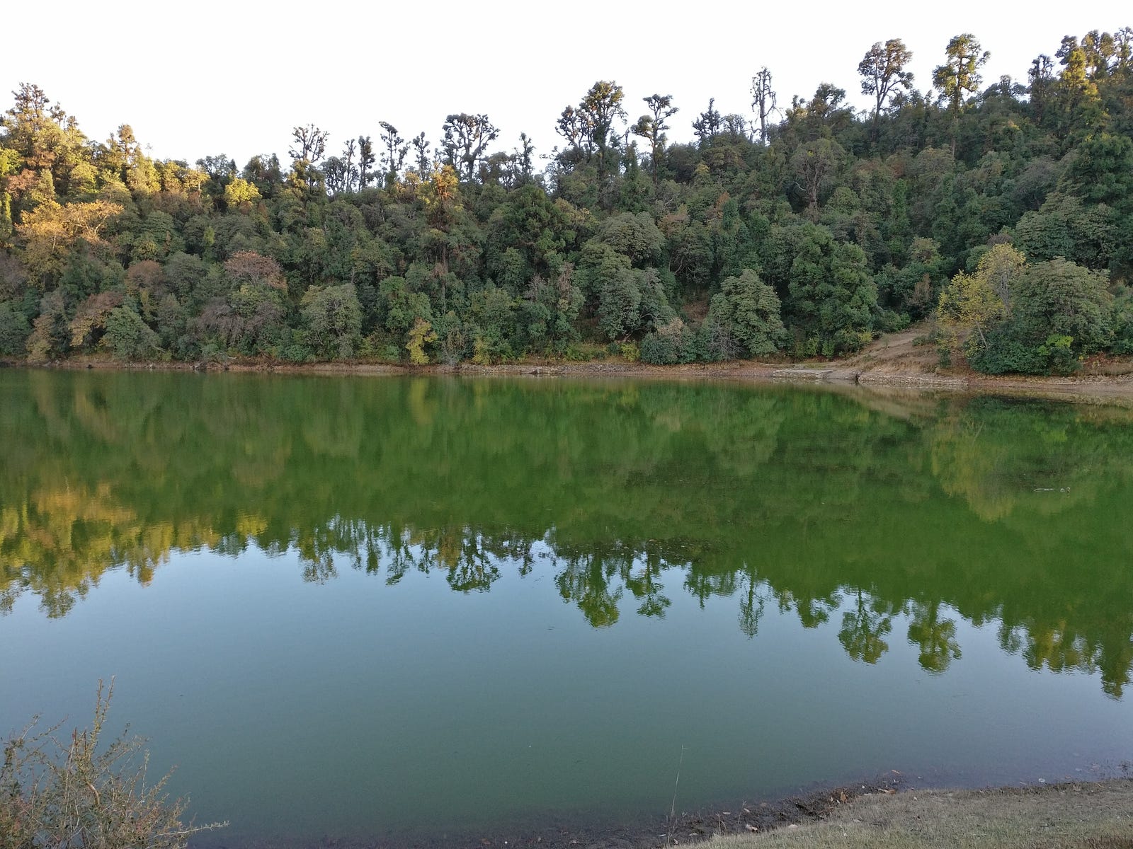
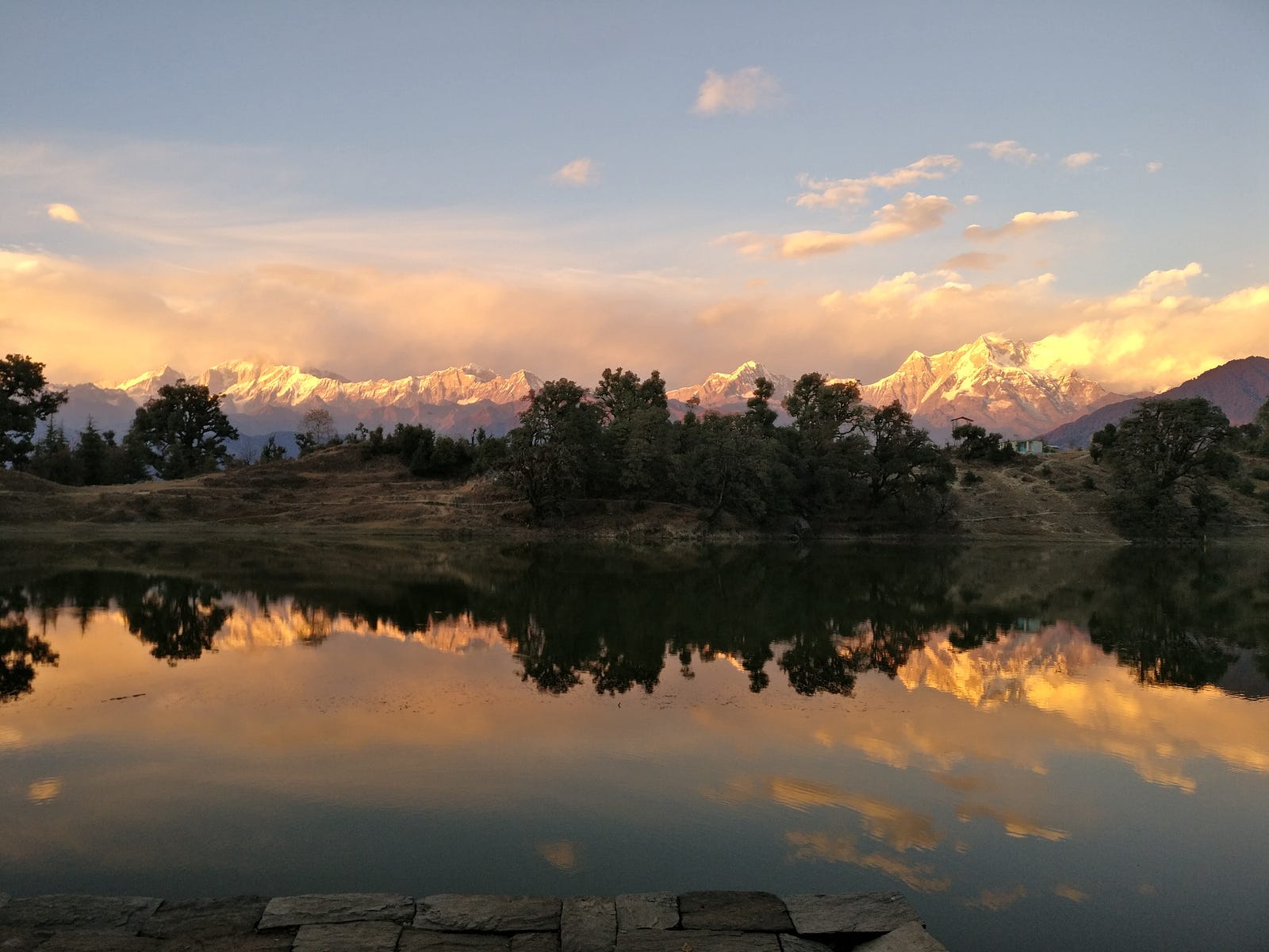
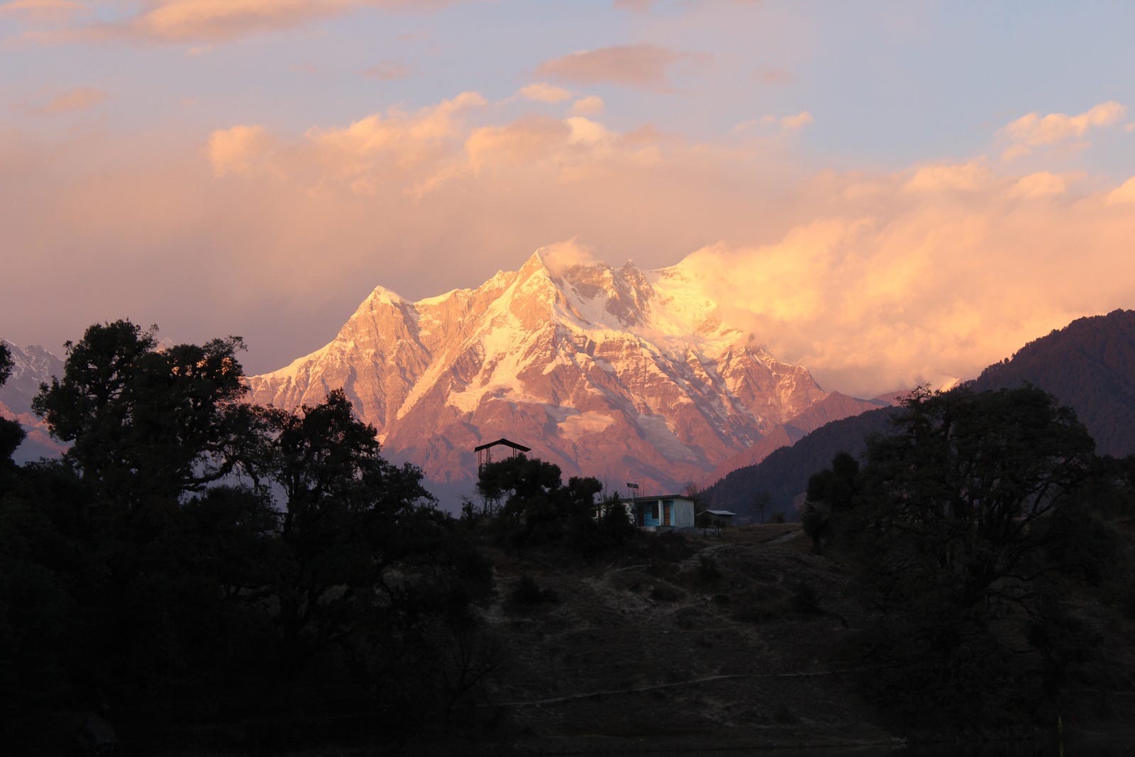
A clear view of peak like Mt. Chaukhambha, and reflections of surrounding trees in it’s calm water could hardly be matched by any other camping site. It is also unmatched in terms of it’s distance from nearest civilization with Sari village being just 2 km downhill. We put our bags and tents nearby the lake and decided to take stroll along the boundary of lake. The sun was about to set, and the surrounding peaks were getting a golden hue.
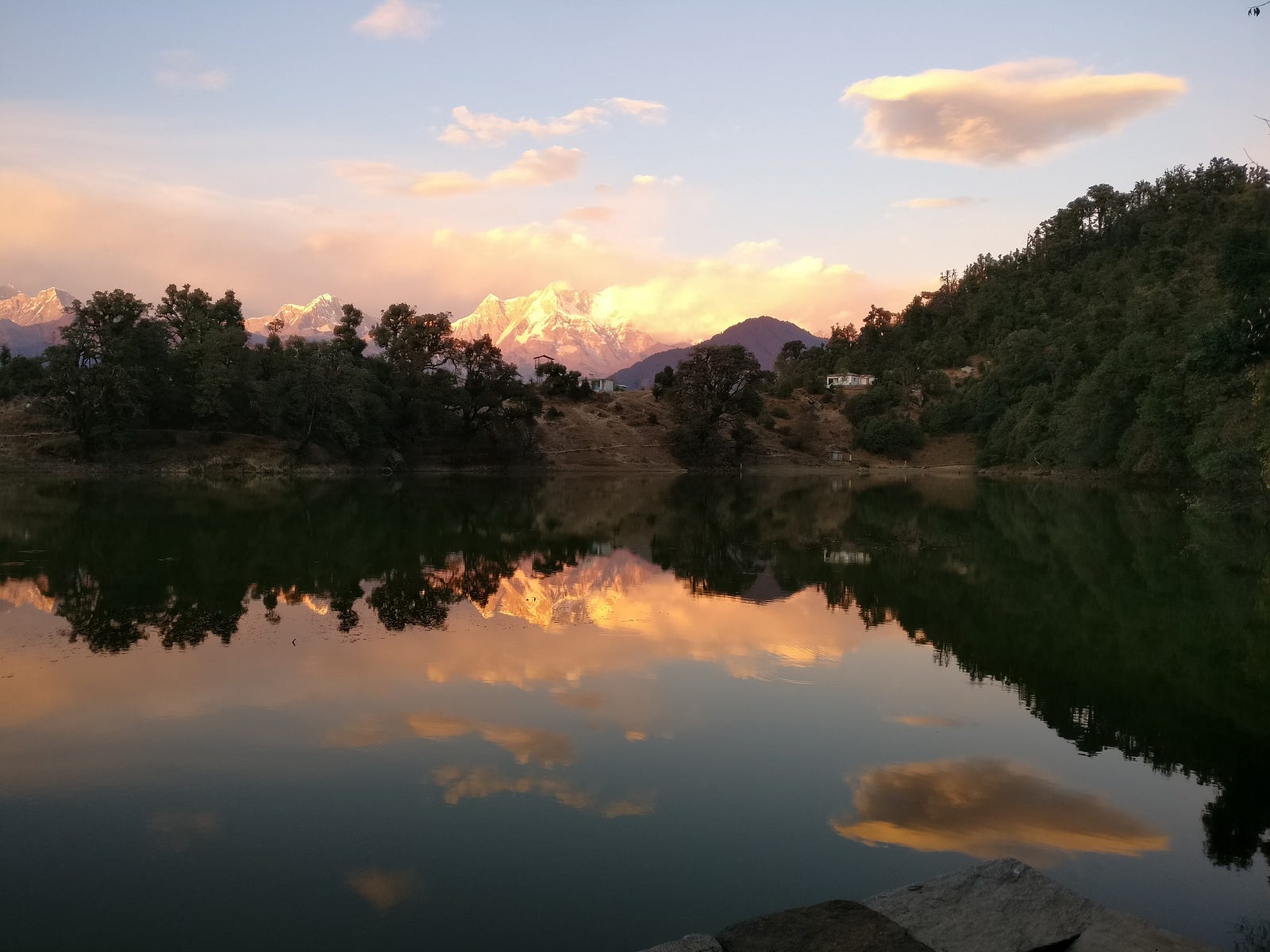
With every moment of setting sun, mountains were getting heavenly.
We rushed to a place to get a best possible view. We couldn’t have enough of it. It felt like as if it has been a long time since I had been away from mountains. Shweta also was very happy to be here. In her words, this place can make a person breathe a new life in themselves.
Before dark, we pitched our tents. The sky was soon filled with stars where we sat under in appreciation. After some time, we went to a nearby shop for dinner. There while having dinner, we asked about the route to Chandrashila via Rohini Bugyal from the shopkeeper. He told us to take a guide as there was very less or no water along the route and there was nobody going through that route these days. I had never taken a guide before but this time was different. I needed to be more responsible than before. I was not sure, how easy this was going to be for somebody new to trekking. We may have to keep on trekking if we couldn’t find water along the way till we find any. Shweta was ready to accept these difficulties. After talking to others in the shop, it was clear to us that water sources along the way had dried up and we may face difficulties because of that. Everybody except us, were going to Tungnath from Chopta which was too mainstream for me. While having dinner, I asked if I could get a guide for the rest of the trek. The shopkeeper told us that he knew someone in the village, who would take INR 1000 per day and we also have to rent a tent and sleeping bag for him. We decided to think over it in night and went back to our tents.
Second day of Trek
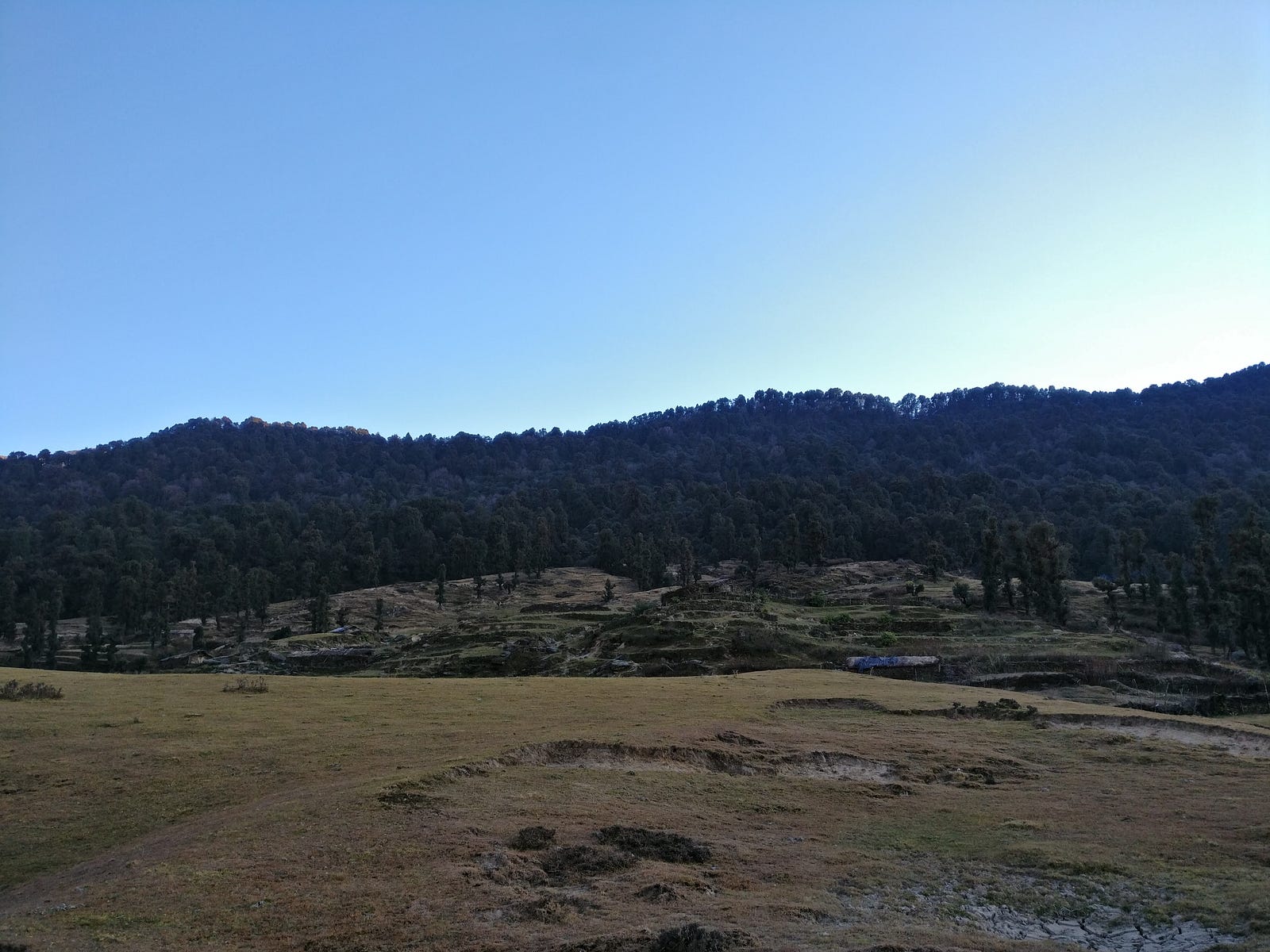
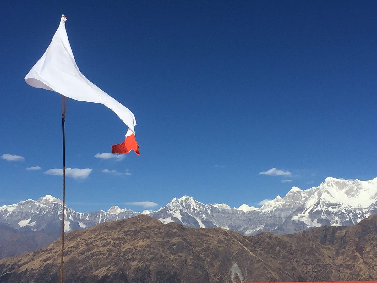
We woke up early and packed our bags. There was a hut of forest guard nearby who gave us the required camping permits. We were ready by 7 AM. What mattered to me the most was to complete the trek without any unnecessary difficulties. While having breakfast I asked the shopkeeper to arrange for the guide he was talking about last night. Meanwhile he was on his way to Devariyatal from home (Sari village), we arranged for his tent and sleeping bag along with some utensils and food items which will be required in coming days. Being extra careful with water, we bought some extra bottles in case we didn’t find any water on the way. Our guide, Umendra Singh Bhatt, turned up almost after an hour and we started as soon as he arrived. Our first stop was Rohini Bugyal and the trail leading to Rohini Bugyal was not long. It ascends moderately till Jhandi Dhar (a ridge with a flag at the top) and passes through a dense jungle thereafter.
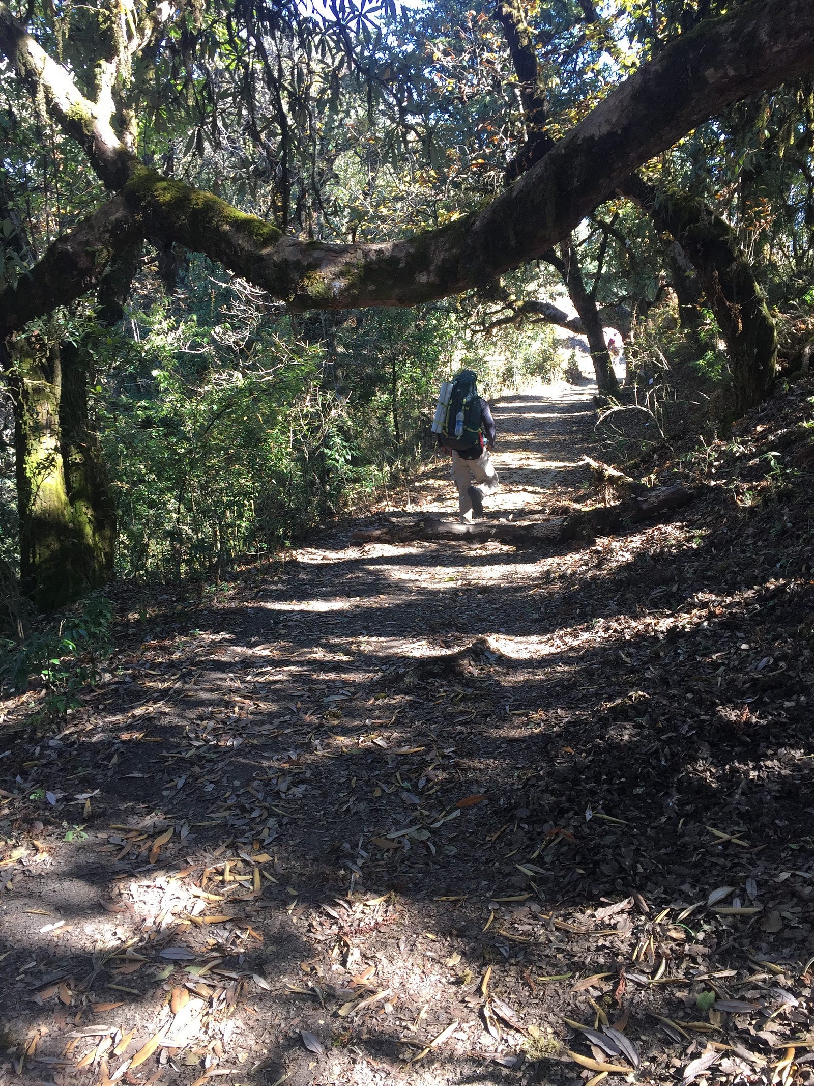
On our right side, we constantly had a view of Sari village. Contrary to what was told, we encountered running streams on our way. After Jhandi Dhar, the jungle becomes dense and beautiful.
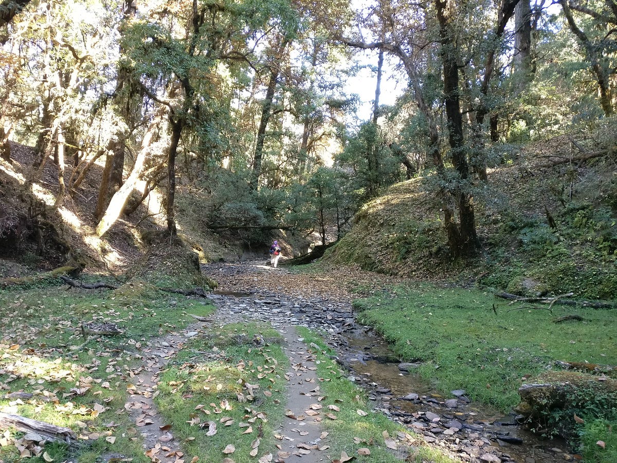
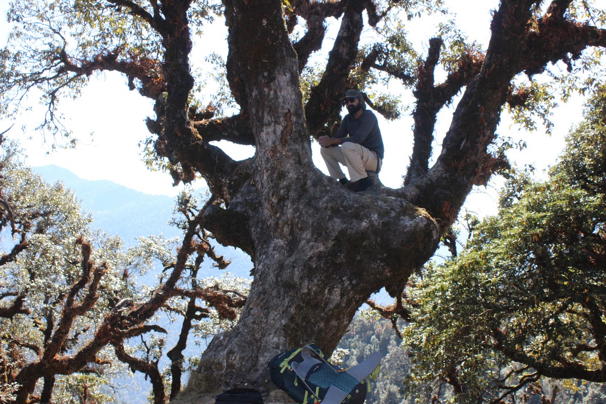
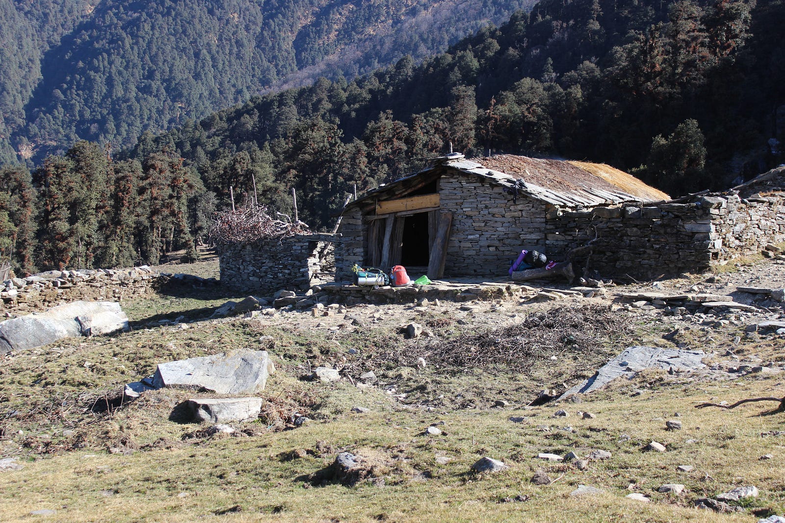
Every now and then I couldn’t stop myself from halting and clicking pictures on the way. We easily reached Rohini Bugyal in 4–5 hours. We decided to halt for the day and the place had few abandoned huts. People living there had left the place not more than a month ago. There was a small stream of water near the place where we decided to camp. Umendra collected some dry woods from nearby place and created a makeshift fireplace with some stones and started to prepare tea. After having tea, we went around to fetch some more wood for night and cooking.
I was curious to know about the places around, so soon after having tea and maggi, we went for a stroll. From our location the view of Trishul peak was blocked by a mountain. Umendra told us that on this mountain, there is a lake called Bisuri Tal which is a high altitude glacial lake. I think it may’ve been known as Vasuki Tal originally. From Rohini Bugyal, a straight trail leads to Bisuri Tal, whereas the trail on the right with initial ascent and then steep descent goes towards Akash Kamini stream coming from Chandrashila.
Usually it takes two more days from Rohini Bugyal to reach Bisuri Tal. Bisuri Tal offers a very close view of Trishul peak and it is one of the less known treks. If time allowed, I was eager to go on this one as soon as we complete the Chandrashila trek. There isn’t much information on Bisuri Tal on internet.
We roamed around the meadow in the evening and as the sun was about to set, the cast it was creating on the mountains was giving such a fascinating view that it was literally a treat to watch. When it was finally dark, we sat near the fireplace to discuss the next course of actions and we decided to start early the next day so as to reach Bhurgali early and continue trekking to Chandrashila after leaving our heavy rucksacks at the shop whoes owner was Umendra’s friend. With this plan, next day was going to be little long. It had more ascent than before. Umendra went to sleep early and we sat there talking near the fireplace till there was no firewood left. After sometime, with not much left to do, we went on towards our tents.
We roamed around the meadow in the evening and as the sun was about to set, the cast it was creating on the mountains was giving such a fascinating view that it was literally a treat to watch. When it was finally dark, we sat near the fireplace to discuss the next course of actions and we decided to start early the next day so as to reach Bhurgali early and continue trekking to Chandrashila after leaving our heavy rucksacks at the shop whoes owner was Umendra’s friend. With this plan, next day was going to be little long. It had more ascent than before. Umendra went to sleep early and we sat there talking near the fireplace till there was no firewood left. After sometime, with not much left to do, we went on towards our tents.
Third day of Trek
We got up early around 6 in the morning and packed our tents and bags. Umendra had already started preparing tea for all of us. After having some tea and biscuit, we left Rohini Bugyal to start our last day of the trek. Past Rohini Bugyal, trail descends steeply towards Akash Kamini stream. On this descend, Shweta started having problems with her knee which made her little slow. But she continued anyway and we soon reached the Akashkamini stream. It originates near the Chandrashila peak. After walking for around 2 hours we halted near lower Bhurjgali. There were few abandoned huts around where we stayed for a while and had some maggi. Umendra seemed to be a very good cook. We both agreed, that we never had maggi tastier than this. It took nearly three hours for us to reach Bhurjgali.
From here onwards, this trail merges to the trail coming from Chopta. In fact Chopta was about a km from here. There was a shop nearby where we left our rucksacks and had some tea. Soon we left for Tungnath and Chandrashila. It is well laid path with carved steps and railings etc. What disappointed me most was the amount of garbage on the way. The task of collecting garbage on the way became more difficult than any other of my treks. Umendra was also helping in collecting the garbage. We were discussing, what could Lord Tungnath offer to those who come and throw garbage around. In an hour or so, we reached Tungnath, though the temple was closed for the season. We offered our prayers and roamed around.
There we met other people who had come there from Chopta. We stayed there for a while and then started ahead for Chandrashila.
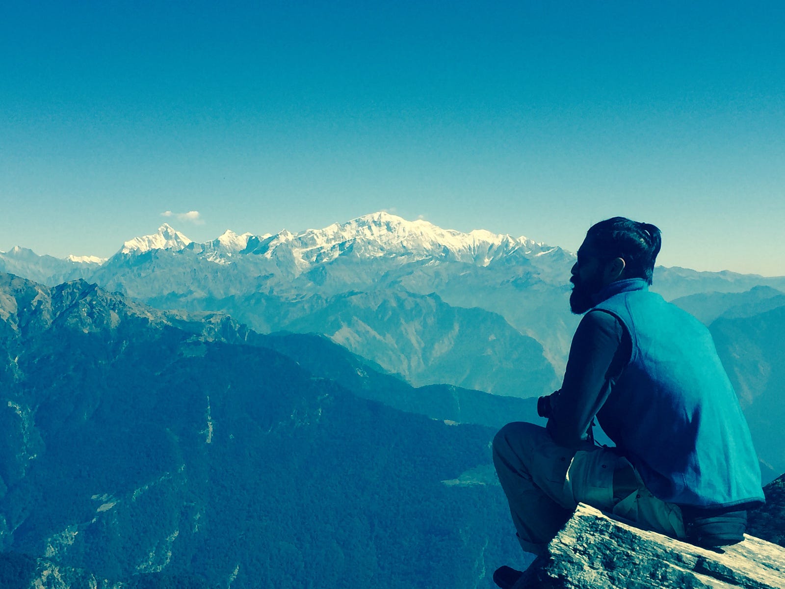
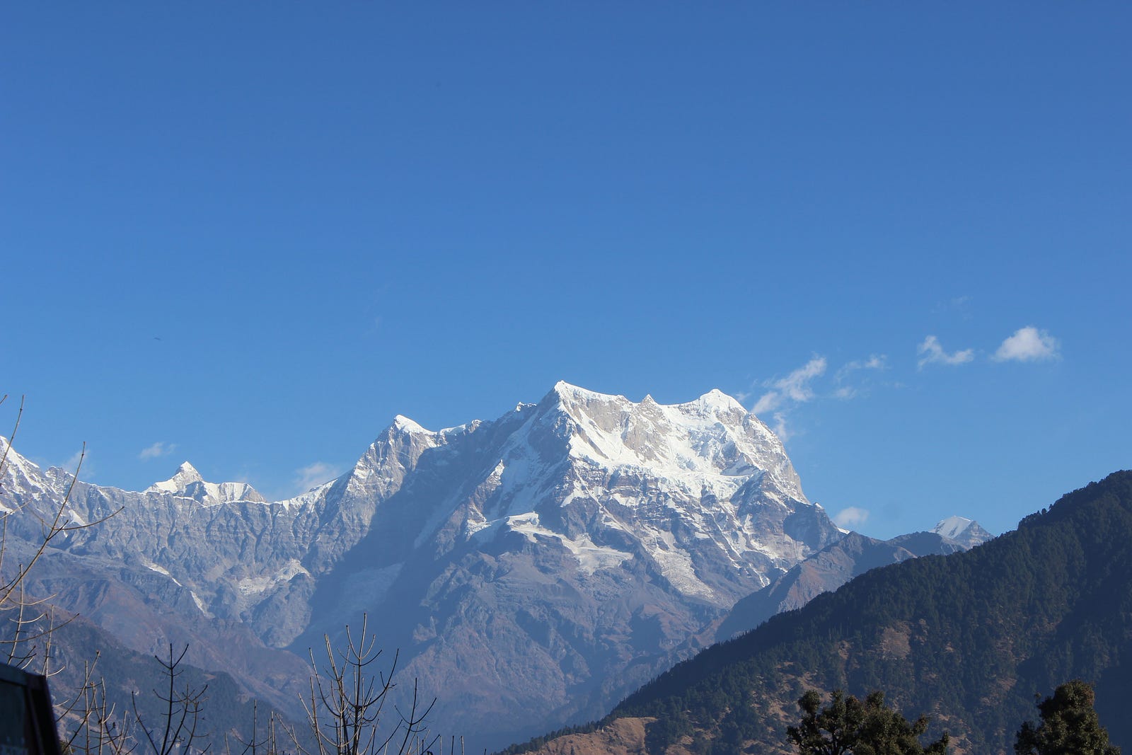
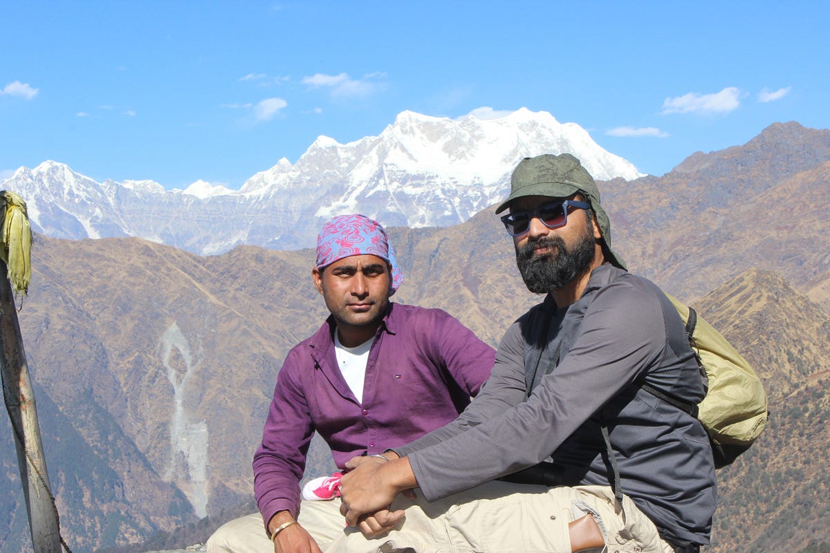
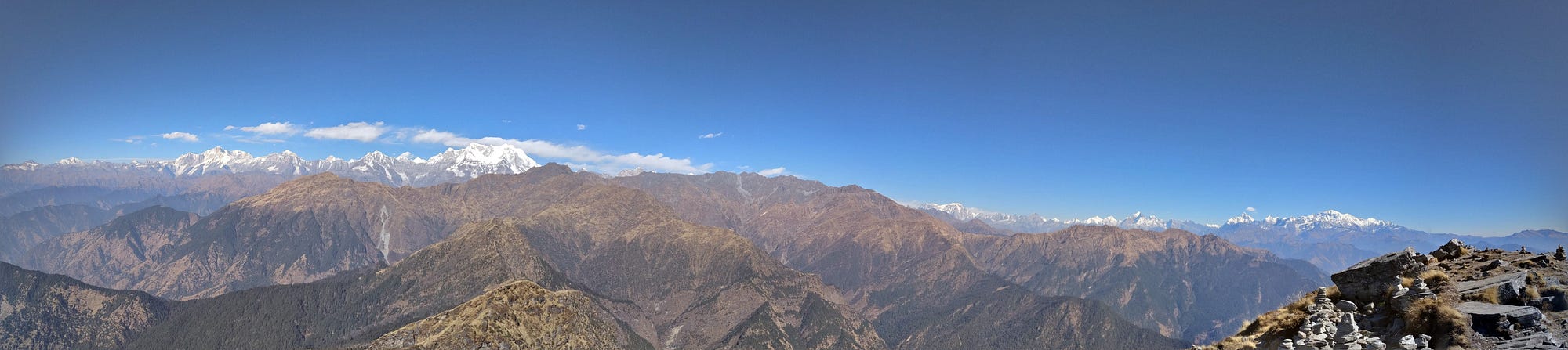
As there was no snow, so it didn’t take much time to reach Chandrashila. There was a small temple up there. As soon as we reached there, all of us offered our prayers to the lord and went ahead with watching the amazing view of mountains. It had been a long time, that I had visited a place which offers such a panoramic view of mountains peaks. We could see a complete 180 degree view of majestic peaks of Garhwal. Umendra told about the various peaks we can see from there and the places around. I had been to the summit of Mt. DKD-II which could also be seen from there. Chandrashila also offers a clear view of Mt. Nanda Devi. From Jaonli to Nanda Devi, every peak was clear to us.
As there was no snow, so it didn’t take much time to reach Chandrashila. There was a small temple up there. As soon as we reached there, all of us offered our prayers to the lord and went ahead with watching the amazing view of mountains. It had been a long time, that I had visited a place which offers such a panoramic view of mountains peaks. We could see a complete 180 degree view of majestic peaks of Garhwal. Umendra told about the various peaks we can see from there and the places around. I had been to the summit of Mt. DKD-II which could also be seen from there. Chandrashila also offers a clear view of Mt. Nanda Devi. From Jaonli to Nanda Devi, every peak was clear to us.
I was carrying my binoculars which also helped me explore these peaks more precisely.
All this time of our stay at Chandrashila, we found ourselves sitting and watching the peaks around. When we were content enough, we started our descent towards Bhurjgali. After walking for almost an hour, we reached Bhurjgali and there we had our lunch and started descending towards Chopta. From Chopta we took a cab to Sari village which Umendra had already called. After a drive of almost 40–45 minutes, we reached Sari, where we stayed for the night before leaving for Haridwar next morning.